Showing 44 results
Archival description42 results with digital objects Show results with digital objects
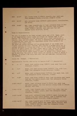
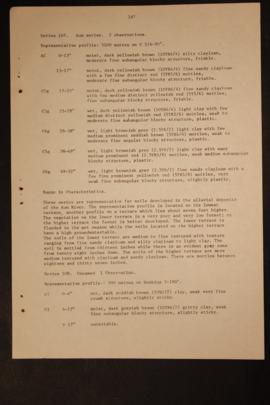
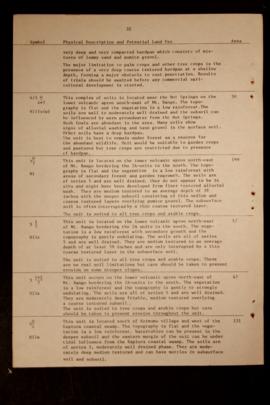
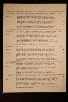
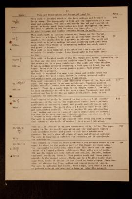
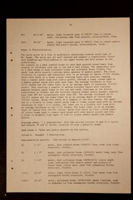
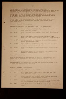
Report Number: 400 Soil Survey and Land Use Potential of the Kapiura-Dagi Area, West New Britain, 186pp. Includes map with scale 1: 50,000
Report Number: 400 Soil Survey and Land Use Potential of the Kapiura-Dagi Area, West New Britain, 186pp. Includes map with scale 1: 50,000
Report Number: 400 Soil Survey and Land Use Potential of the Kapiura-Dagi Area, West New Britain, 186pp. Includes map with scale 1: 50,000
Report Number: 400 Soil Survey and Land Use Potential of the Kapiura-Dagi Area, West New Britain, 186pp. Includes map with scale 1: 50,000
Report Number: 400 Soil Survey and Land Use Potential of the Kapiura-Dagi Area, West New Britain, 186pp. Includes map with scale 1: 50,000
Report Number: 400 Soil Survey and Land Use Potential of the Kapiura-Dagi Area, West New Britain, 186pp. Includes map with scale 1: 50,000
Report Number: 400 Soil Survey and Land Use Potential of the Kapiura-Dagi Area, West New Britain, 186pp. Includes map with scale 1: 50,000
Report Number: 400 Soil Survey and Land Use Potential of the Kapiura-Dagi Area, West New Britain, 186pp. Includes map with scale 1: 50,000

Report Number: 168 Buvussi Pota Galai-Galai Soil Survey. I.S Huria, 'Physiographic Proto-interpretation of Buvusi/Galai Area, Papua New Guinea', 1984, International Institute for Aerial Survey and Earth Sciences, Ts., 7pp. R. Zijsvelt, 'Interim Report of Pota Galai Soil Survey - till 23-2-1968', 24 Feb 1968, Ts., 7pp. B.W. Strong, 'Progress Report on Kumbango Flood Recording', 12 Feb 1968, Ts., 13pp. R. Zijsvelt, 'Report on the North West Pota Galai and Galai Block', n.d., 11pp. Includes flood map 'Kumbango, West New Britain District', by B. Strong, 30 Jan 1968, and soil Map 168, 'Buvussi-Galai Pota-Galai', by R. Zijsvelt, 23 Aug 1968. Includes map with scale 1”=40 chns

Results 31 to 40 of 44