
'Aerial view of farmed land on Tongatapu with Liahona on right side of photo, Tonga'
- AU PMB PHOTO 126-004
- Item
- September 1968 - May 1969
Part of John Baker slides of Tonga
Baker, John R.
'Aerial view of farmed land on Tongatapu with Liahona on right side of photo, Tonga'
Part of John Baker slides of Tonga
Baker, John R.

'Aerial view of farmed land on Tongatapu between Liahona and Atele, Tonga'
Part of John Baker slides of Tonga
Baker, John R.
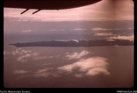
'Aerial view of eastern end of the Munda Bar'
Part of Slides from John Baker’s Voluntary Service Overseas placement in Solomon Islands
Baker, John R.
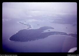
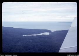
'Aerial view of eastern end of Tetepare Island'
Part of Slides from John Baker’s Voluntary Service Overseas placement in Solomon Islands
Baker, John R.
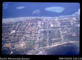
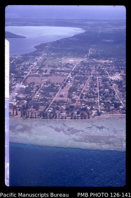
'Aerial view of downtown Nuku'alofa, Tonga'
Part of John Baker slides of Tonga
Baker, John R.
'Aerial view of downtown Nuku'alofa, Tonga'
Part of John Baker slides of Tonga
Baker, John R.
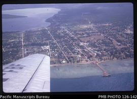
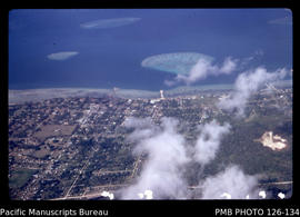
'Aerial view of central area of Nuku'alofa with Vuna Wharf and Mala'e Panga, Tonga'
Part of John Baker slides of Tonga
Baker, John R.
'Aerial view of central area of Nuku'alofa with Taaufa'ahau and Vaha'akolo Roads, Tonga'
Part of John Baker slides of Tonga
Baker, John R.
'Aerial view of Veru Harbour with the eastern tip of Tetepare Island'
Part of Slides from John Baker’s Voluntary Service Overseas placement in Solomon Islands
Baker, John R.
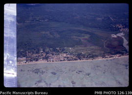
'Aerial view of Sopu reclamation area to the west of Nuku'alofa, Tonga'
Part of John Baker slides of Tonga
Baker, John R.