"The Yuat, continuation of Baiyer, wending its way through Schrader Ranges out to Sepik Basin" (from Cessna).
"Cape Moem, Wewak."
"Elizabeth - last steep descent to waterfall."
"Lumusa on the ridge. Note the new road which local M.H.A. Traimya had built."
"Where the Winyi road and the Lumusa road meet - the new bridge over the Laname River. ? part of Highlands Hway or branch off it."
"C.L.T.C (Christian Leaders' Training College) Banz, Wahgi Valley, W.H.D. (Theological, Educational, Agricultural, Technological)."
"Admin block - C.L.T.C. Banz."
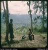
"On way to caves - Kanyimareta in middle distance, Hagen range far distance."
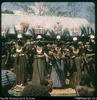
"Pastor of Giimanda church in centre wearing new yambalii."
"Kompian mission station - up a mountainside. Baiyer lies many ridges beyond (behind). From air. The govt. airstrip is flat, but on approach you see a sheer cliff ahead with deep gorge below, and skim over the top edge to touch down on flat terrain."